News and Events
May 2012: Launch of the EOC website, including new and improved versions of the Development MapTool and the GMS Interactive Atlas.

New EOC website and knowledge tools
April 2012: Ten GMS government staff successfully trained on "GIS models to improve SEA" at ITC / University Twente (NL).

GMS government staff trained on GIS for SEA
November 2011: Application of predictive models in the SEA of the Quang Nam Land Use Plan 2011-2020 presented at the Modeler Expert Group Meeting in Enschede (NL) and NASA Land Cover Land Use Change Meeting in Hanoi.
August 2011: ADB launches 'Environments of the Poor' Geodatabrowser, built on Google Maps and Chart API's.
May 2011: IAIA Mexico - Training on biodiversity modelling for SEA using the example of the Viet Nam SEA of the Quang Nam Land Use Plan 2011-2020.
October 2010: COP 10 Nagoya - launch of first version of the GMS Development Maptool, an interactive application to map development projects, built on Google Maps API V3, PHP and MySQL.
April 2010: IAIA Geneva - Side session on SEA in the GMS, raising awareness on integration of scenario-based spatial models.
Recent Publications
Elsevier Environmental Impact Assessment Review: 'Integrating spatial support tools into strategic planning-SEA of the GMS North-South Economic Corridor Strategy and Action Plan' Download
GMS Environment Operations Center: 'Applying spatial tools to support sustainable planning in the Greater Mekong Subregion' Download
Geographische Rundschau: 'Change at the Periphery. Economic and Political Rapprochement in the Southeast Asian Border Regions between China and India.' (in German) Download
GIS Business: Interview with the German magazine "GIS Business" for their column 'GIS experts abroad'. Download
Journal of photogrammetry, remote sensing and geoinformation processing: 'Comparison of different classifications at the example of high-resolution imagery near Leipzig.' (in German) Journal
Spatial Data
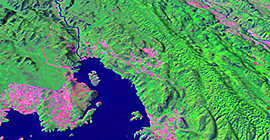
More than 1 Terabyte of GIS data on environmental, economic and socio-demographic topics is currently available.
3-D model of Srinakarin hydropower dam
Greater Mekong Subregion -
GIS data developed & under development: